-

-
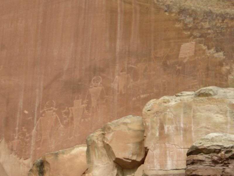
I still have two more weeks of riding and pictures to post up. It gets better...
-darrell
-
-
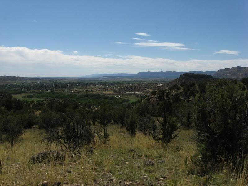
While I was visiting The Girl, we poured over the maps of the West, discussing where I should go next.
Her: Olympic National Park
Me: West, or Southwest.
Her: You need a plan.
Me: I planned on coming here, the rest I make up as I go.
Her: Augghhh
So, I guess I made a rough plan. I wanted to see the sign that warned of a road hazard for the next 99 miles. I believed that to be in Idaho, on 12. So that would be the direction I would head.
Thursday we said our goodbyes and I headed off in the general diection of Lolo Montana, the start of Rt 12.
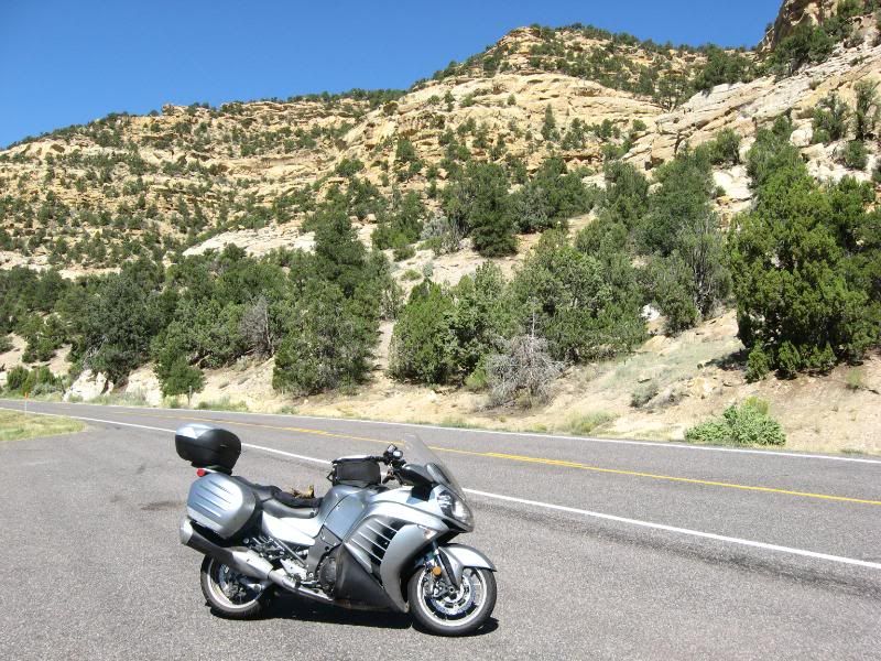
Well, first part of the plan successful: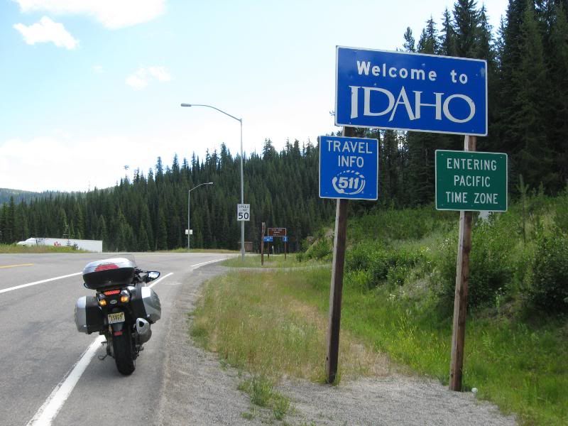
Not a few hundred feet beyond, jackpot: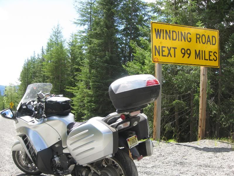
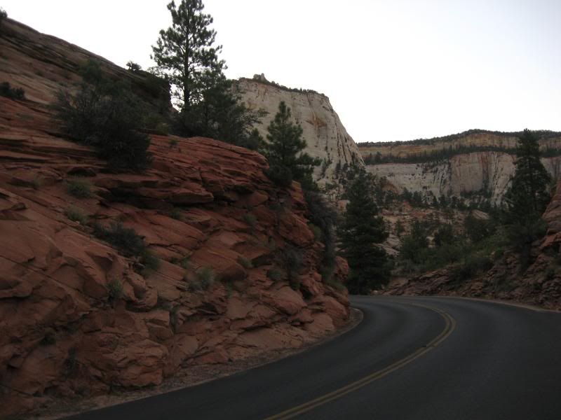
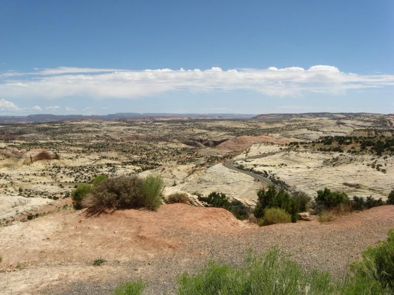
The guys in Cody weren't lying. 12 was a beautiful road, following the banks of streams, weaving though the hillsides: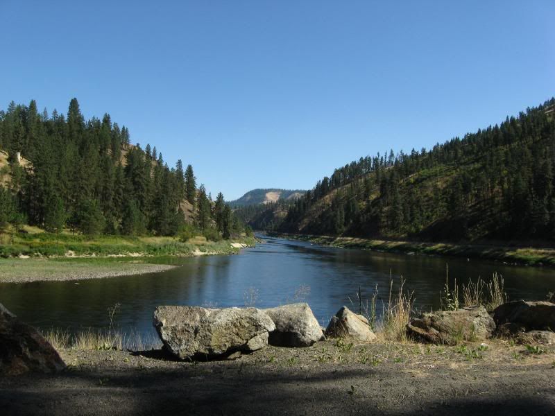
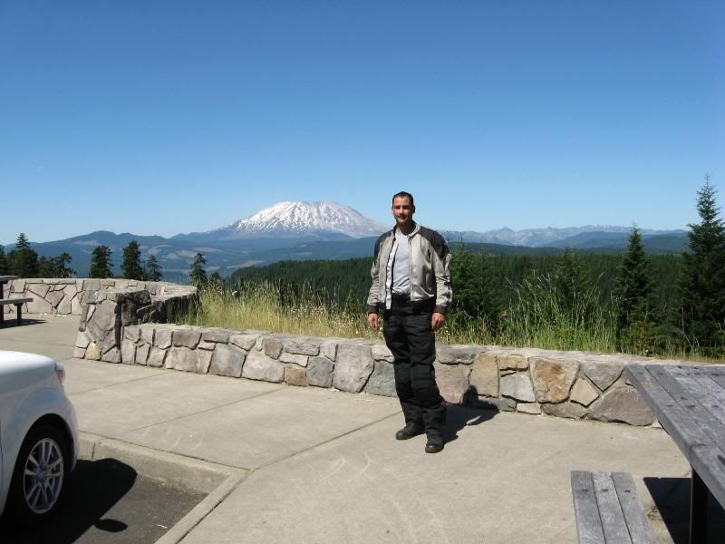
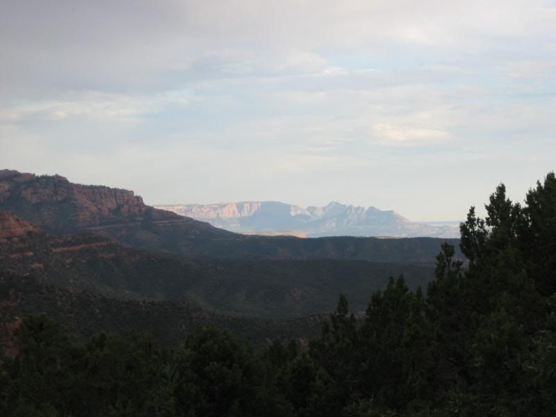
I continued on 12, into Washington, and into one of the cities I've always wanted to say I've been to.
I don't know if a Bugs Bunny cartoon when I was a kid put this place into my head, along with Albuquerque, but I just needed to see it: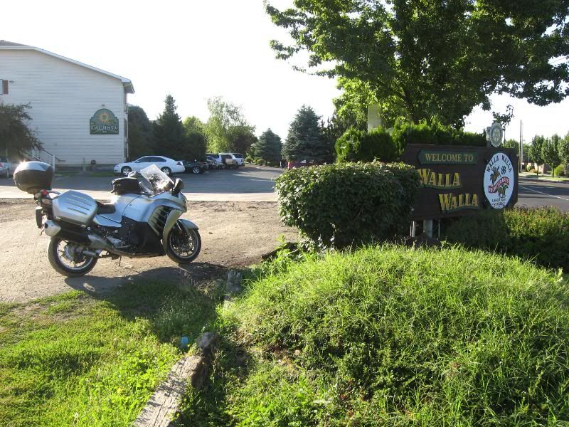
Looked like a nice little town. Never knew wine was so big out here. But, I managed to find a brewery for dinner and tasted the local fare. Not bad, not bad...
-darrell
-
-
Stumbling back to my hotel that night I knew I had decisions to make. Am I gonna head North to the Cascades, West to the coast, South to scenic rides through the Oregon Mountainsides?
Since I made it this far, one thing is for sure though: My sister and BIL live in Corvallis. I need to get over there to pay a visit.
With that in mind, I looked over the maps of Washington and Oregon and made a rough plan in my clouded vision. I would head North. West. Maybe a bit South first. A solid plan.
-darrell
-
-
The next morning I headed West on 12, then jumped Southwest on 730, entering Oregon. I jumped onto 82 North but got off as soon as I crossed the bridge.
I then followed 14 and the Columbia River going West.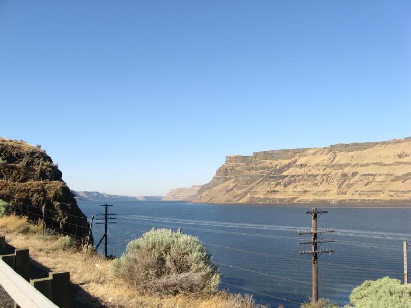
View of Mt. Hood from 14: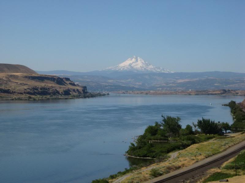
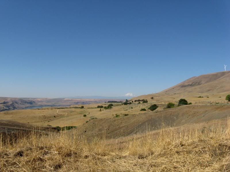
I continued on 14 until I reached Carson. I turned North there and picked up Rt 30, took that to Rt 51, then jumped on 25. What great roads. Not a single straight stretch to speak of. Oh, and the views weren't bad either: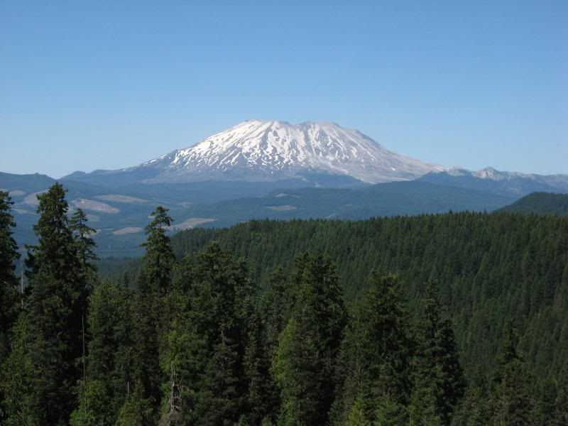
You don't see this in Jersey:
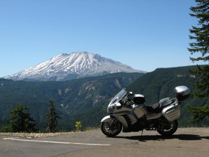
I continued on 25 up to Randle. I then headed East on 12 to 123. I was this close, I might as well see all the snowy peaks in these parts: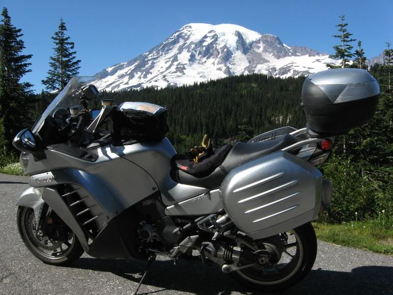
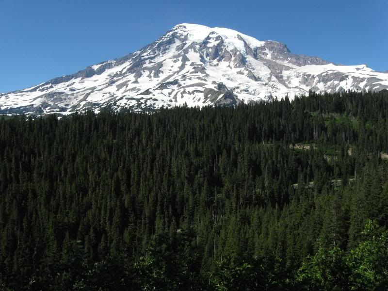
I went West through Mount Rainier National Park, then headed South on 7 back to 12. I took 12 over to I5, with a stop for a reminder of the local speed limits. Thanks for verbally remindng me, and not putting it in writing.
I took I5 up to Olympia, where I then jumped onto 101. The Girl's reminders of how nice Olympic National Park had been ringing in my ears all day, so I had to check it out.
Her's where my refusal to backtrack bit me in the ass a bit. There's very little on 101 in the way of hotels, and what there was, was full. I rode up to Sequim till I found a hotel with a vacancy, but the clerk's refusal to drop a triple digit price when the place had barely anybody there caused me to continue on. I knew I shoulda backtracked to Olympia. Oh well, on I go.
I pulled into Port Angeles around 10 pm. The first place I stopped said the whole town was booked and I'd have to backtrack to Sequim. No way.
The next place I stopped had one room left, for less than what the hotel in Sequim wanted. I'll take it. Mc Donalds and a sixer and I was out for the night.
-darrell
-
-
Great pics, I can't wait for my first trip out west.
-
-
After the early morning run in Glacier, and seeing Ike's pics of when he heads out early in the morning had me decide to get up early to venture into Olympic National Park.
Since I got into town late, I had no idea what I was in for. A quick peek out the hotel window gave some clues:
I decided to do Hurricane Ridge Road. Wise decision.
On the way up there, looking out over the waterways:
Looking the other way: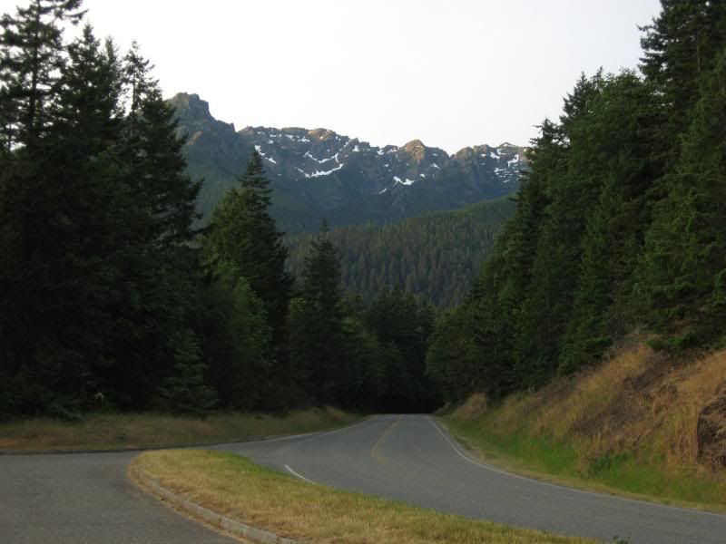
Back towards the water: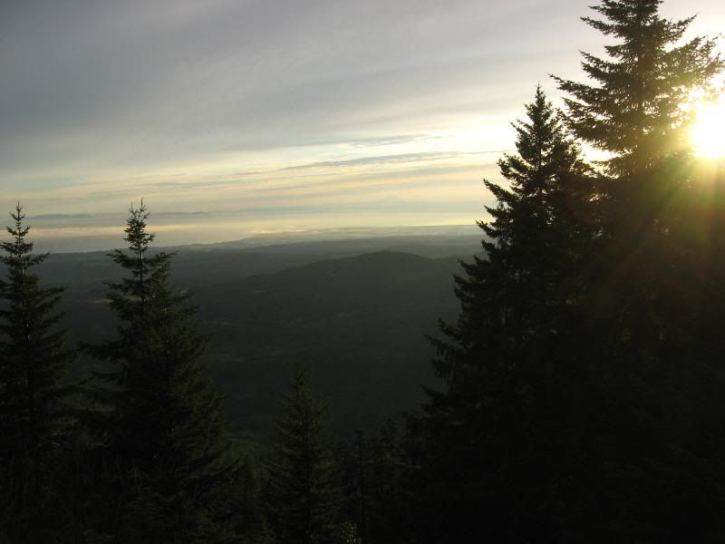
I continued up the road and was greeted by view that just about took the breath away. Pictures just don't do it justice. At least my pictures don't: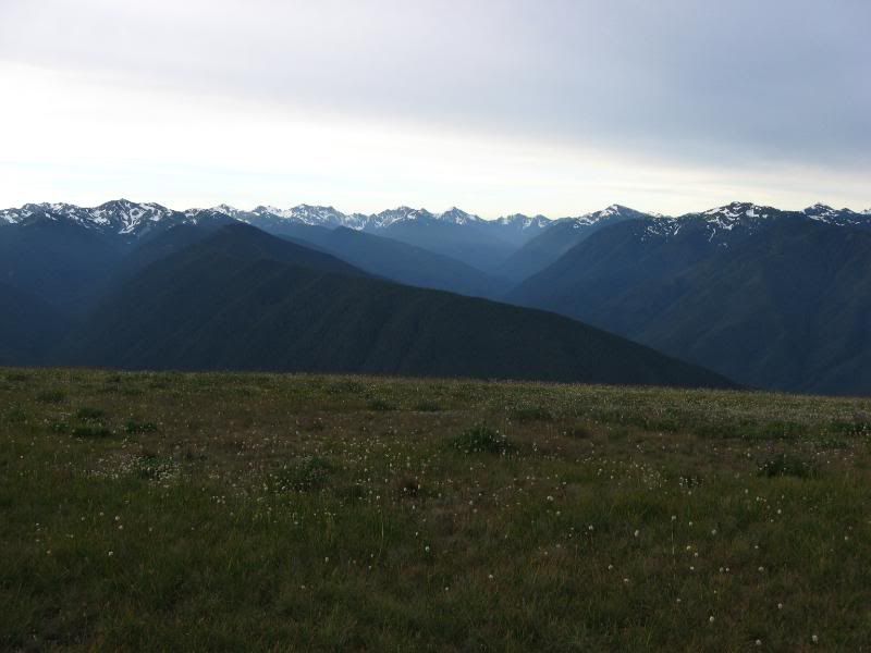
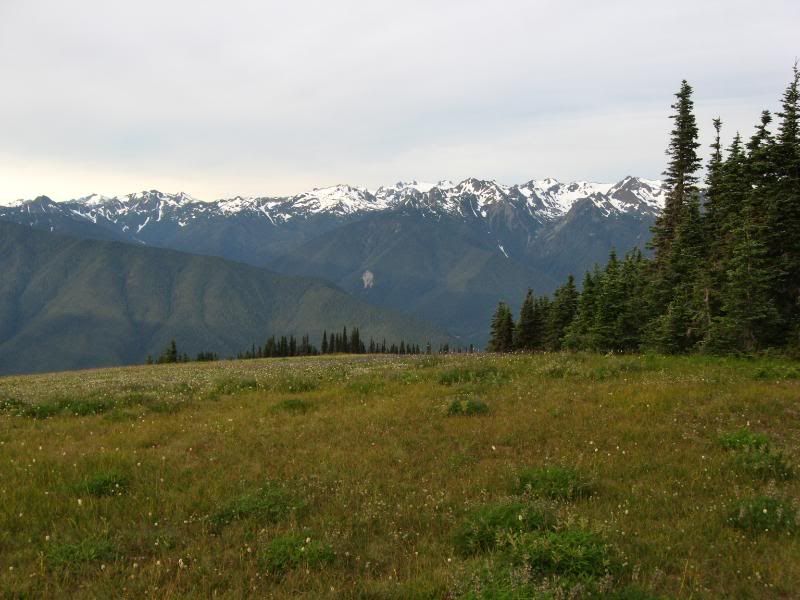
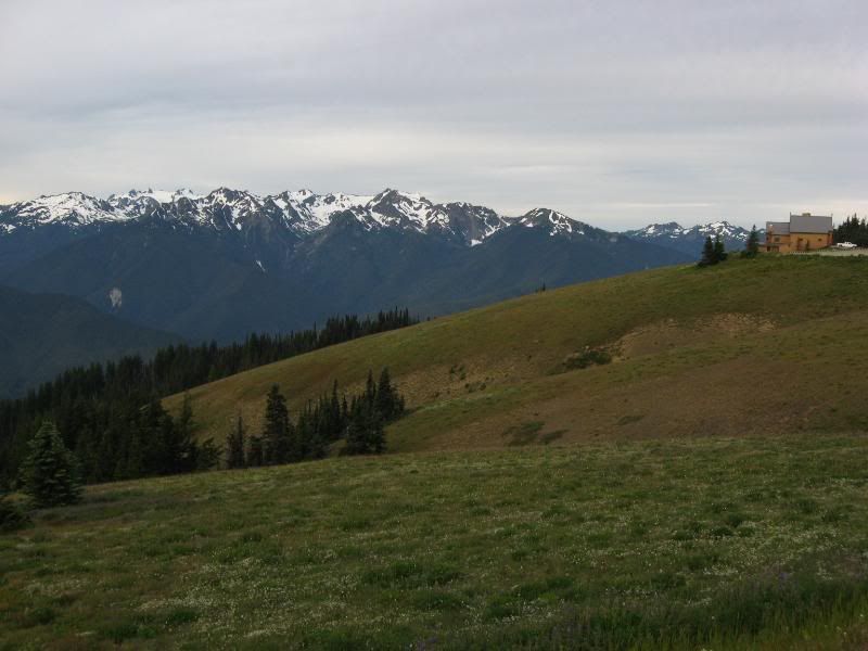
Amazing. It was a 180 degree view of the mountain ridge. What a sight.
I was able to get out of the park before any traffic and jumped back on 101, heading toward Forks.
I jumped off of 101 just before Forks and continued West on 110, and headed towards Rialto Beach.
And, there I was: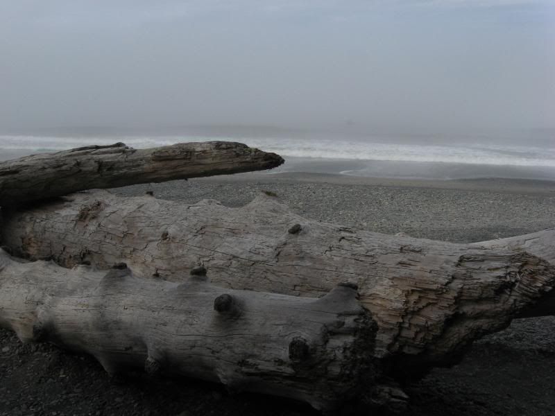
The Pacific.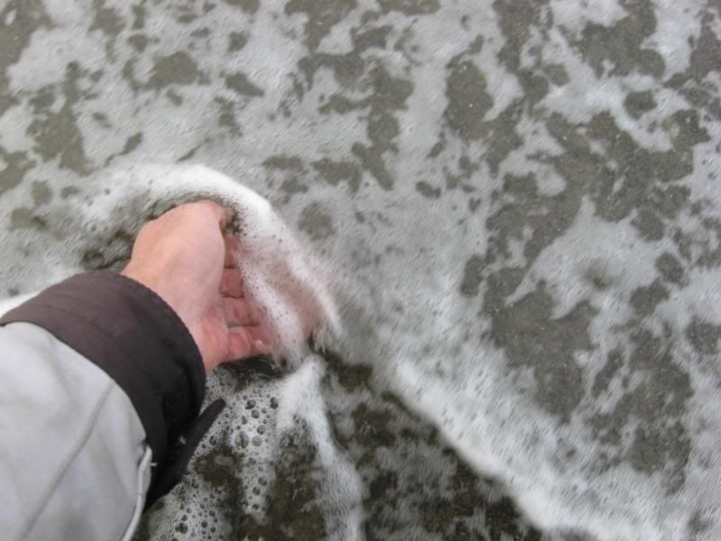
I made it clear across the country. What a difference in waterfronts.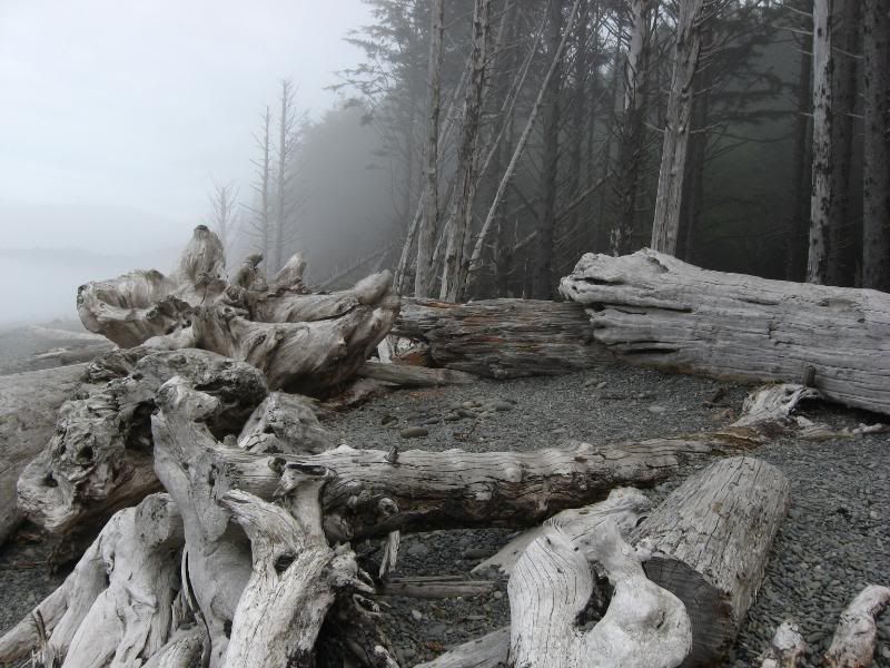
I grabbed a quick shot before leaving: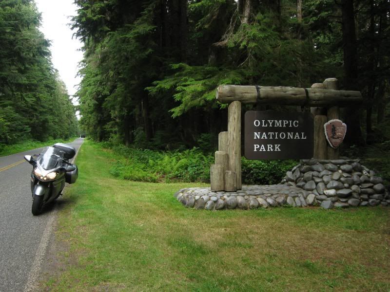
I checked out the Hoh Rain Forest, then continued South on 101. The coast was beside me the whole ride. I think.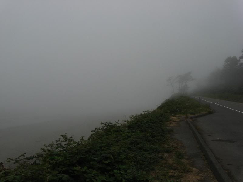
I crossed back into Oregon on 101 and headed towards Tillamook for the evening, the whole way in the misty fog of the Pacific.
-
-
Great pictures, great write up, and a great story Darrell. Thanks again for sharing it with us.
-
-
Wow, cool stuff! That is something I'd like to do someday.
-
-
I had been in contact with my sister in the previous days, and we had figured a mid-afternoon meet-up would work best for her. No problem.
I rolled into Corvallis at 11 am and attempted to locate her place.
Not hard.
My sister is a vegetarian, and grows alot of what she eats. When she lived back here in Jersey her front yard was everything edible. I quickly saw her home in Corvallis was the same, just on a smaller scale: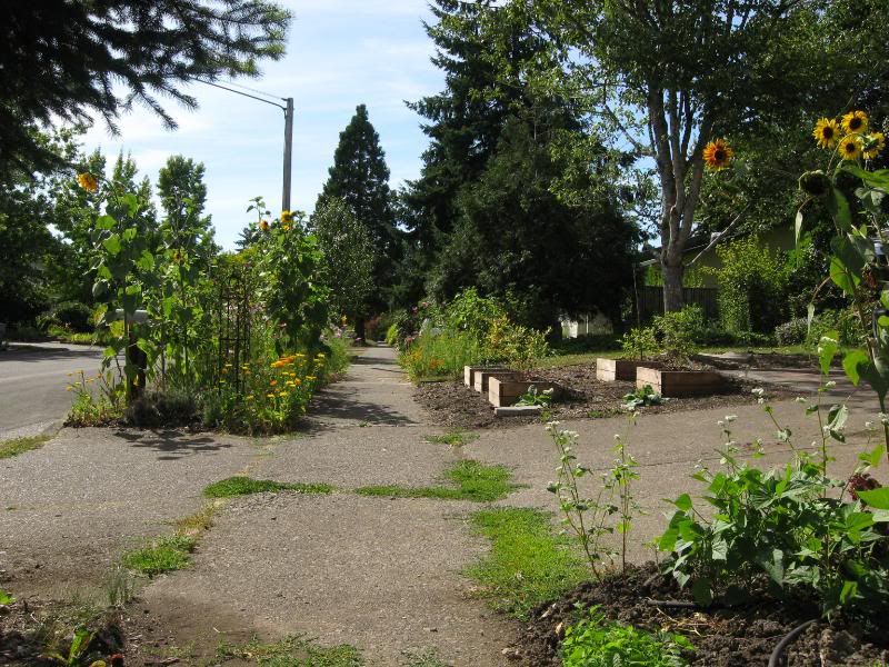
I had some time to kill before she got home, so I set out in search of a cure for my pancake craving. A diner was quickly located and I had my fill. Still lots of time before she gets home.
I decided to go explore downtown on my own for a bit. I located some motorcycle only parking, donned my sunglasses, secured my gear, and set out on foot to see what I could find.
Not 200 feet from where I parked was the doorway to a place called Block 15. A brewery. How convenient.
I sat myself down at the bar and sampled the local fare. Good stuff. Really good. I settled on the Duke IV and proceeded to cleanse my brain of the weaker cells. After my fill I continued on my exploration.
I checked out the storefronts, poked my head into a few places, and generally got the lay of the land. Pretty soon the pancakes had wore off and I was looking for something to top off with. It was then I found myself in front of American Dream Pizza. Their list of toppings was somwhat bizzare, but it called to me. I ended up ordering a smoked gouda and artichoke heart slice of pie.
I filled up a large soda, plopped myself in a seat on the roof, and proceeded to thoroughly enjoy a very tasty slice of pie, all while doing a little people watching.
After a bit of a rest, I checked the time. Where does it go? Time to start heading back to meet Sis. I called friends back home on the way back to the bike. Floods, earthquakes, and a looming hurricane was all that I was missing. Looked like I picked the right month for vacation.
I pulled into my sister's driveway and couldn't help but chuckle at everything she had going on in that front yard: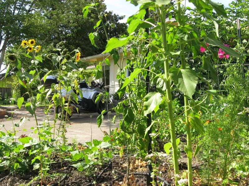
Sunflowers, hops, rosemary, basil, blueberry bushes... it was quite a garden.
Sis pulled up not 5 minutes after I put my kickstand down. She pedals to work, as it looked like a lot of the folks do around there. Bike trails were abundant.
After unpacking and a bit of catching up it was decided a trip back downtown was in order for dinner. Since my Brother in Law had their car for a trip out of town, I'd have to make like the locals and pedal. No problem: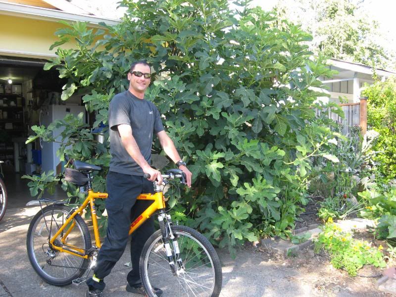
We ended up going to another brewery, Flat Tail Brewing, for dinner. Her friend was the brewmaster there, and he had some deliscous brews lined up for tasting. I ordered some BB-Q, washed it down with a few pints, and ordered his habanero-cucumber brew "El Guapo" for dessert. It was damn tasty.
The ride back to her place was a bit more challenging than the ride there, but amusing nontheless.
After arriving back at her place, the fridge was raided and my BIL's home brews were tasted and approved. He's won a few awards for his brews, and I was amazed at just how tasty each one was.
I managed to make it to my bed that night, tastebuds happy and belly full.
I'd wait to plan where I was going the next day for the morning.
-
-
WOW awesome ride and report Darrell, thanks for sharing.
I'm looking forward to the rest of the story and in the mean time, this one's for you ...........
-
-
Since my one planned stop had happened almost a week prior, each evening, or in this case, morning, I looked at the map and tried to get a rough outline of the day ahead. This morning it looked like Crater Lake would be the first stop.
After downing a good cup or two of stong coffee, saying my thanks and goodbyes, I was on the road again.
I wish I had a bit more time to spend with my sister, but this was planned on the fly. She had no real time to prepare for my arrival, and my BIL wasn't even in town when I got there. I'm gonna have to plan a vacation within the next few years that includes some quality time with them. But just to get a quick visit with my sister was great anyway.
Anyway, I fueled up and pointed the bike South on I5. Round about exit 124 I jumped off and headed East on OR 128. This was it. I had now made the turn that was gonna start leading me back home. I could have left my sister's and headed West back to 101, but instead I made the decision to start winding my way back towards home.
OR 138 was another beautiful ride, following waterways and winding up and down the hillsides and eventually into the Cascades.
I entered Crater Lake National Park from the North and decided to wind my way around the Eastern side.
Mom and Pop were out here last year and they said this was one park not to miss. Something about the blue water.
I've never seen water so blue. I've seen clear water, cedar water, blue/green water of the Keys, blue deep sea water, and the almost black/blue water of northern lakes, but this was a new blue to me: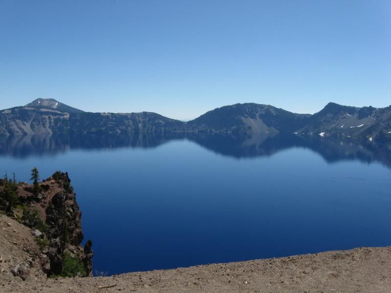
Amazingly blue: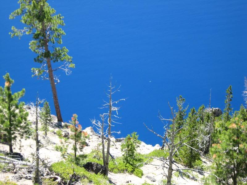
I wound my way around the park, taking in the beauty (and the blue).
In case you missed it, blue water: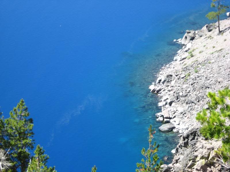
I exited the park and continued Southeast on OR 62 to 97 South. I rode a bit next to Upper Klamath Lake, then Jumped onto OR 39, which quickly turned into CA 139.
OK you Kalifornistanians, WTF is up with the vehicle inspections at the borders? I would have really liked to find out myself, but was waved right through on the bike. I thought I was at a border crossing.
I won't forget very soon the intense smells 139 provided me with. The sage, and then the pine smell were amazing. Just another reason I love to travel on two wheels. If I was in a cage I'd never had know the smell was so intense up there.
Anyway, I stayed on 139, with a short stint on 299, and eventually met up with 395 around Susanville. I followed 395 down into Reno, and managed to find a place to crash in Sparks for the night.
-darrell
-
-
Now, there's a few places I know in a few states where I say, "If I'm ever here, I've got to do this, just so I can say I did."
Walla Walla was one of those places. And Nevada held another. Rt 50.
I headed out of Sparks on I80 and jumped off in Fernley. I hit 50 somewhere betweeen there and Fallon. Once outside of Fallon, the road started looking like it could be the lonely kind. Problem was, there were vehicles all around. Well, not all around, but there were some a ways in front, some a ways behind, and plenty going in the other direction.
One thing I did find interesting (humerous) was all the stuff people had written out with rocks on the sides of the roadway. For miles and miles, people had gathered up rocks and written whatever pleased with them off the sides of the roadway.
There was alot of road construction going on, whigh gave me ample time to take some pictures: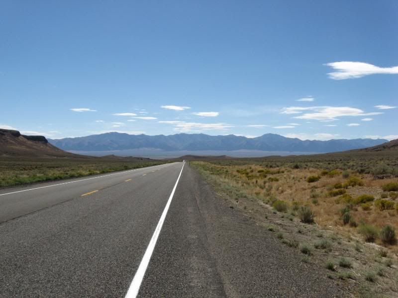
I took 50 almost the whole way across the state, but jumped off when I came to NV487. That quickly turned into UT21: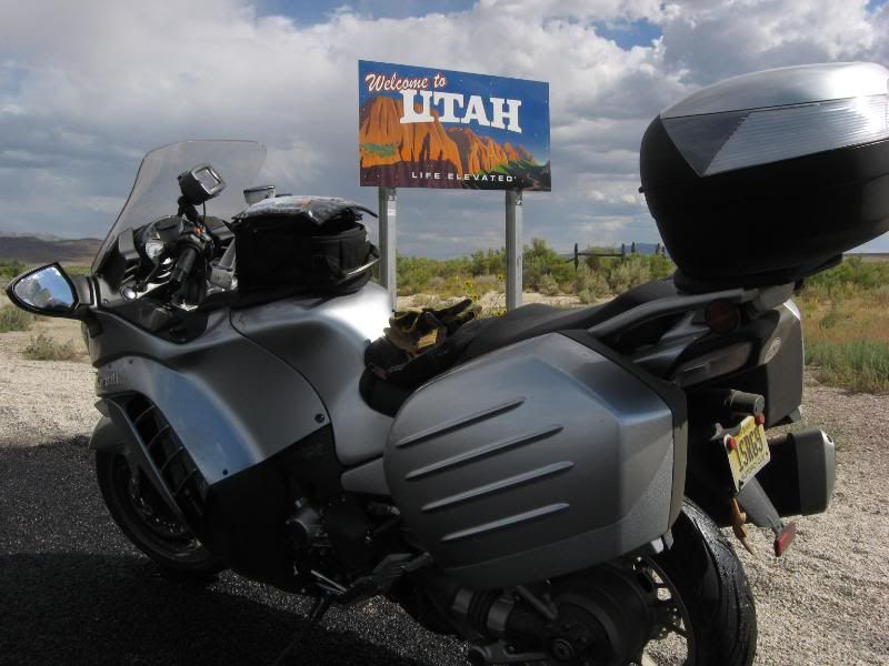
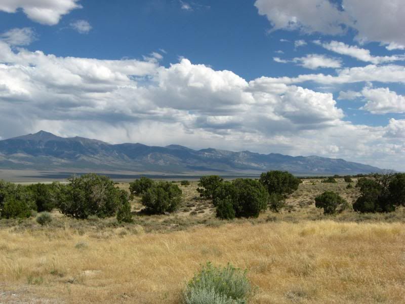
The Girl had been spoutin the virtues of Utah for a while, and I really wanted to explore this state. The first impressions were great. Where 50 was a bit crowded, UT21 was desolate.
If I passed 6 vehicle on this road I'd be amazed. There was nobody, and nothing: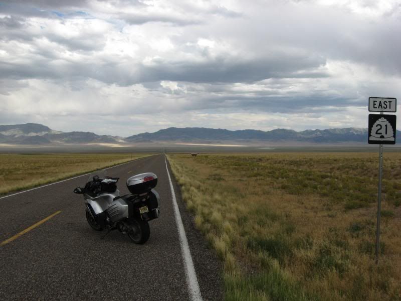
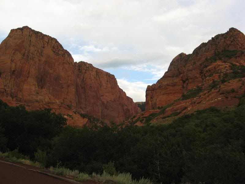
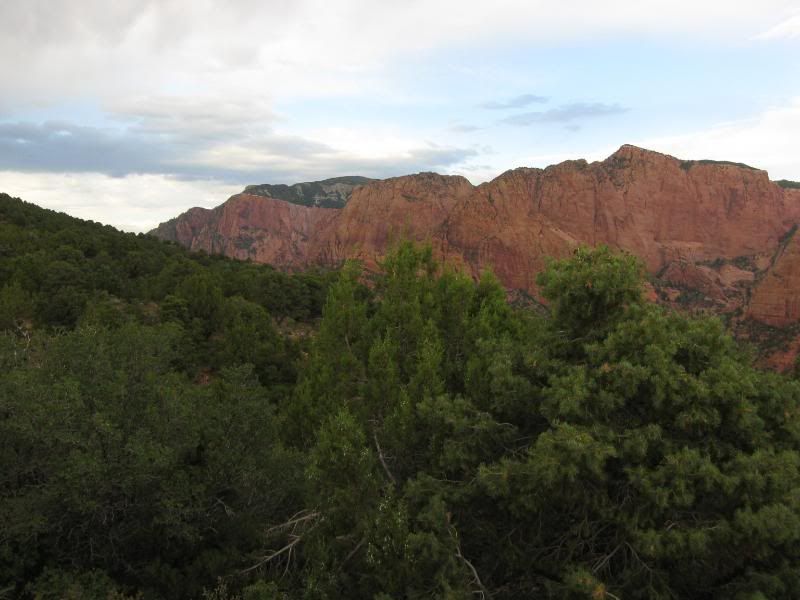
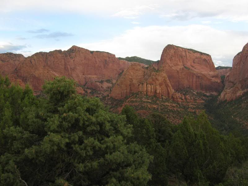
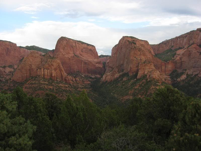
I ran this road all the way to Minersville, then turned South onto 130. I took this to I15 and hopped off there when I saw a sign for a scenic road in Zion National Park.
Now, I thought I was ready for this. I thought I knew what these red rocks were all about. I was wrong.
I get chills when I see amazing things. I was shaking like a leaf when I was driving through here. Just amazed at what I was seeing: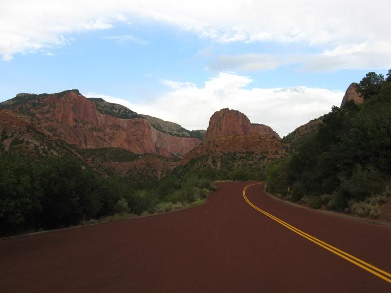
After talking with some folks at the top of the sceninc drive, I made my way back to I15 and eventually down into Hurricane for the night.
-darrell
-
-
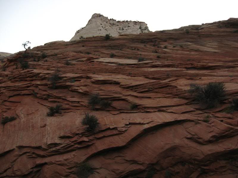
I decided to wake up early in Hurricane and head for Zion for sun-up.
I was riding through rock canyons while the sun was struggling to light the morning skies. The silhouettes of the rocks against the lightened morning skies were amazing. If I had any type of photo skills I'd have taken hundreds.
The sun was just starting to light my way as I passed the entrance station to Zion on Rt 9. Another park with road construction. They had layed the gravel, but not compacted or tarred it, which made for an interesting ride on Zion's switchbacks.
But it was still a beautiful ride.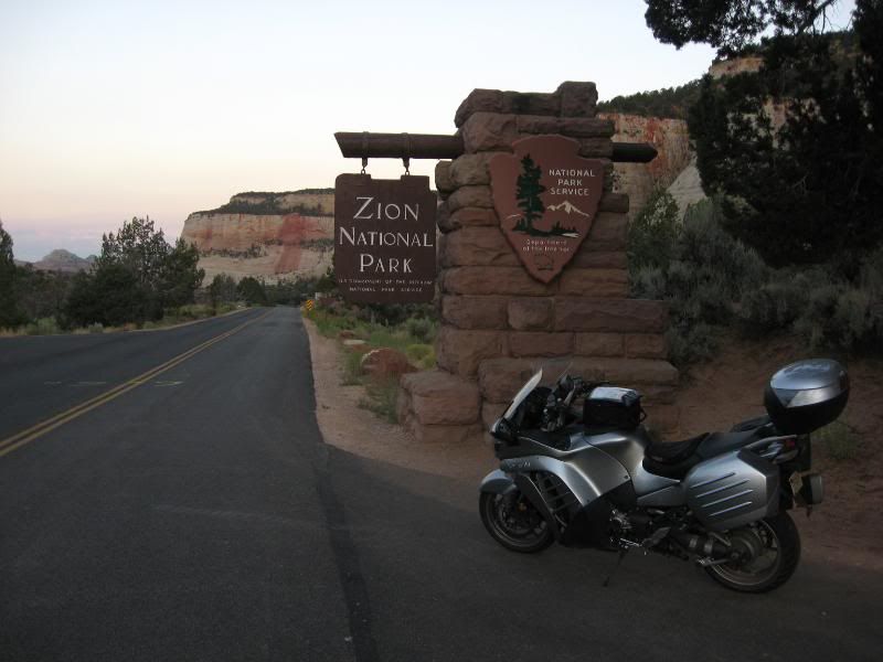
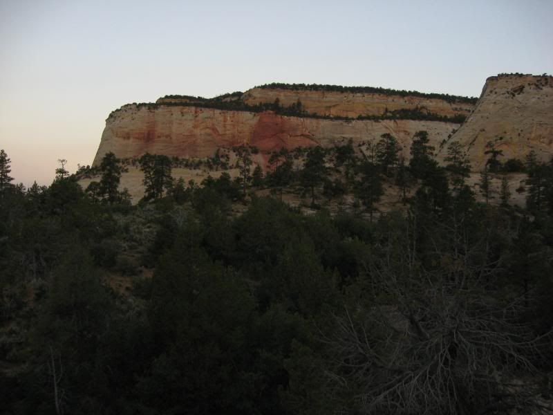
I rode East out of the park and then turned North on 89 in the early morning coolness.
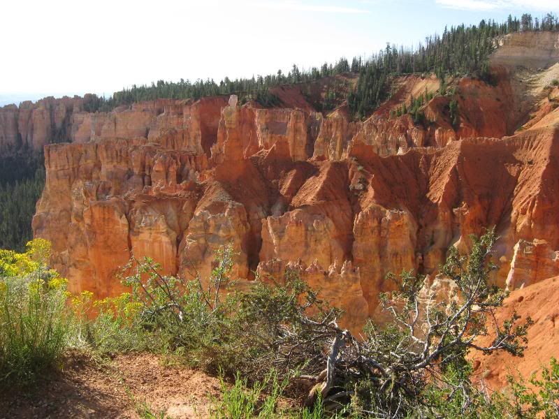
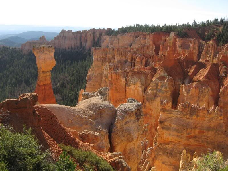
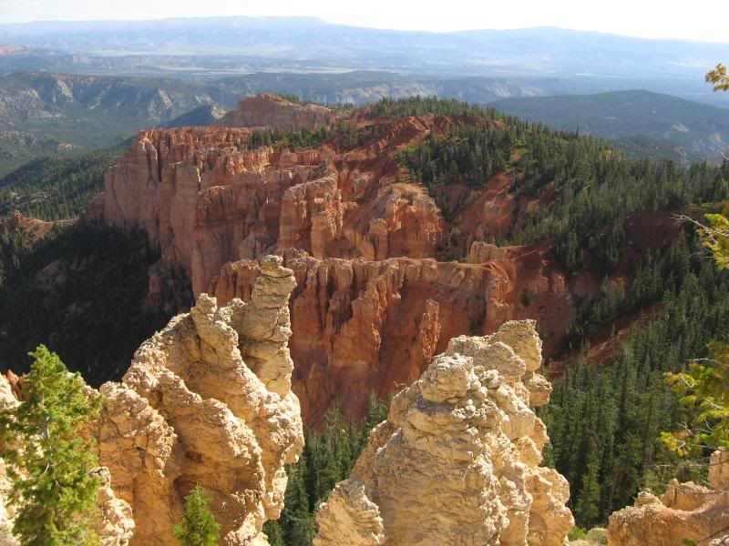
I turned East again on 12 and made my way into Bryce Canyon National Park. Again I got here early enough to miss the crowds, which I really had no desire to tango with.
Bryce looked like another world.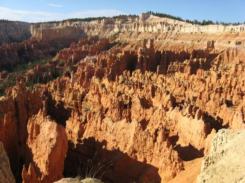
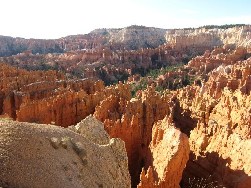
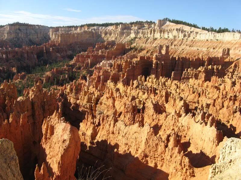
I took a bunch of pics here because it was easy. I could pick up the camera and just hit the button. No matter where it was pointed it would be an amazing picture.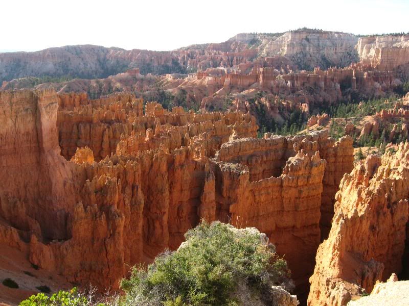
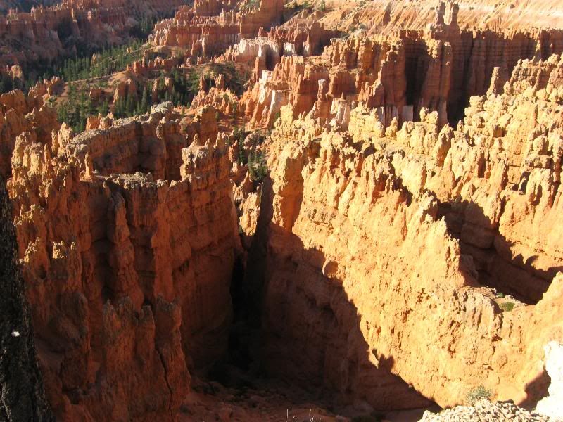
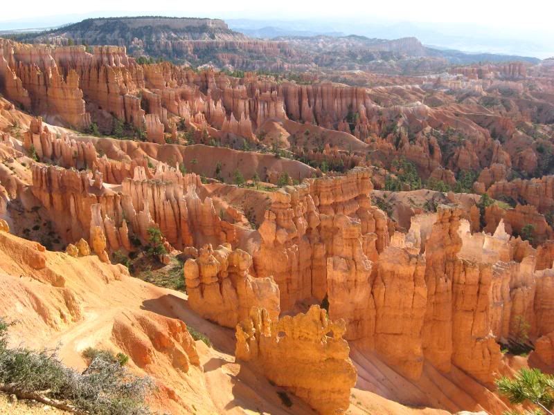
This was one of the parks that I spent the most time at. I would have liked to spend at least a full day in each park I went to, but even then, that wouldn't be enough time. And with the schedule I was pushing, I needed to just look and move on.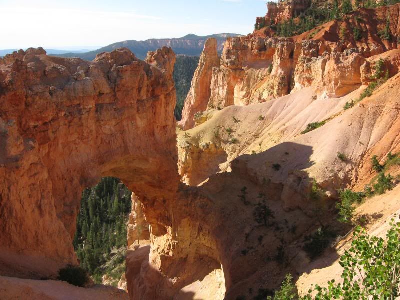
After I managed to remove myself from that park, I continued on 12 through Grand Staircase Escalante National Monument...
-darrell
-
-
Epic thread here, love it Darrell!!


-
-
Looking over my SPOT map, it's August 25th when I left Hurricane and headed towards Escalante.
So, where were we. Oh yeah, Grand Staircase.
What a beautiful ride. Each turn layed out another great view.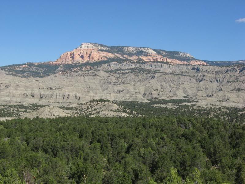
Now, last year Mom and Pop did a tour of the country towing their trailer from campground to campground and generally living like retired folk do. They mentioned something about a petrified forest somewhere. Looking at my map, there happened to be one right on my way to Escalante, Escalante Petrified Forest State Park. I thought I should check things out.
A two minute departure from Rt. 12 and I was at the Ranger Station. I got some park literature, was pointed where to park the bike, and shown the trailhead to get to said forests.
Once again, time for a stroll. I grabbed my sunglasses, a bottle of water and set off.
Ut oh: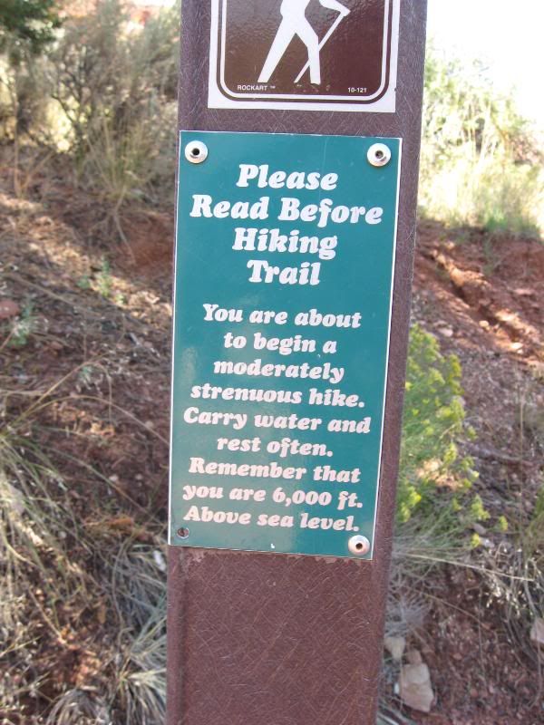
Now, I reside at maybe 100 feet above sea level. I was already feeling this altitude each time I had to push the bike around a bit. Oh well, I wouldn't have to push the bike around on the trail. Onward I went.
Just past the trailhead, a view of the lake below: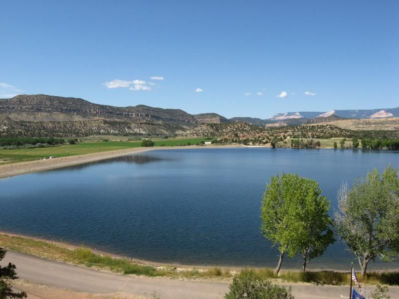
Some interesting sights on the trail, at least I thought so: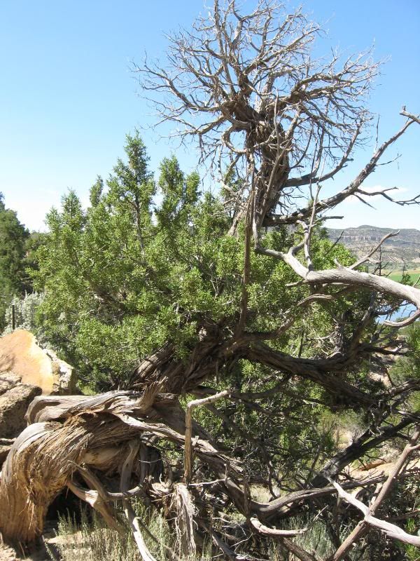
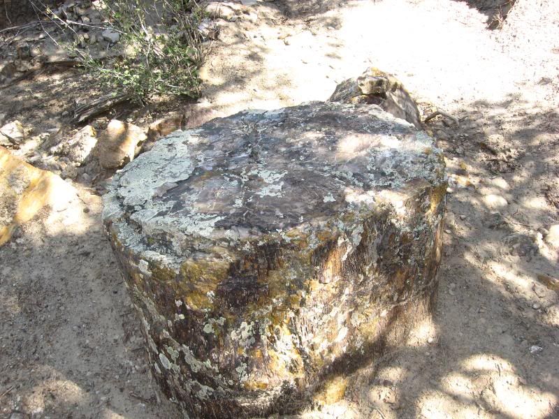
Now, I was expecting a dead looking tree that was hard as a rock for the petrified stuff. Boy, was I wrong. These pieces were colorful. Almost looking like glass. And there was quite a bit all around.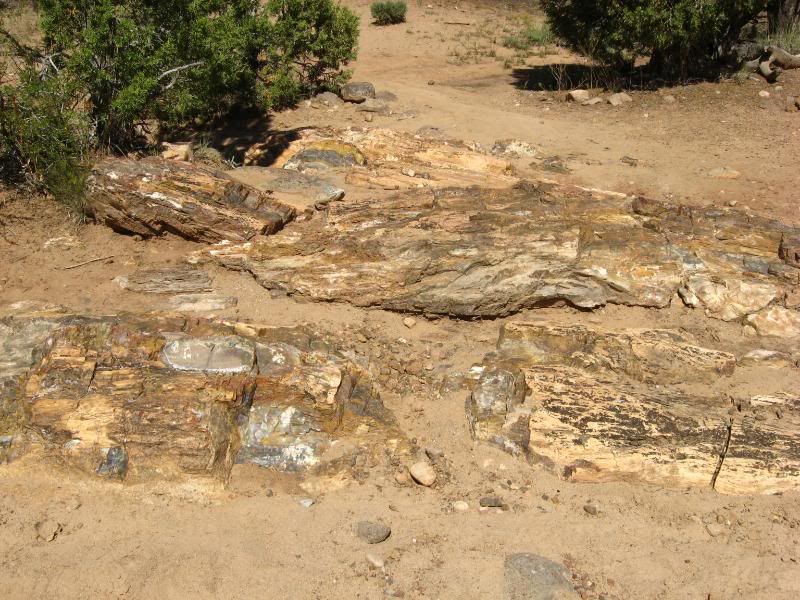
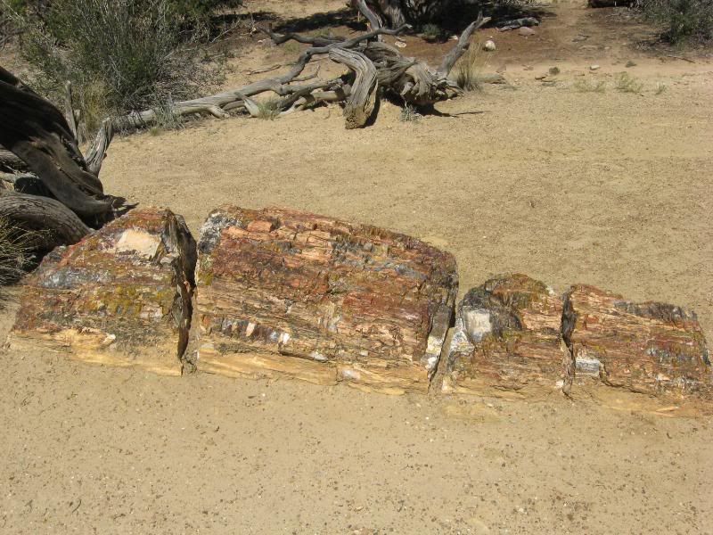
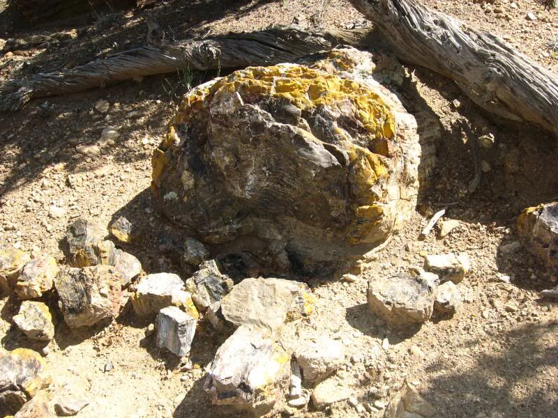
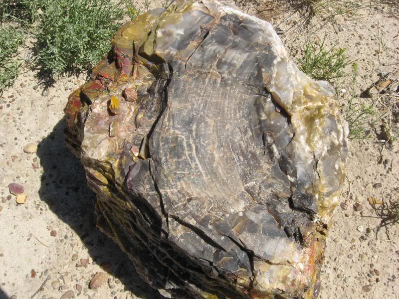
I couldn't stop inspecting each and every one I came across. They amazed me with how they were frozen in time. And the sheer size of them resembled nothing that was growing there today. I tried to imagine what the scene must have been like when these giants were still pointing towards the skies.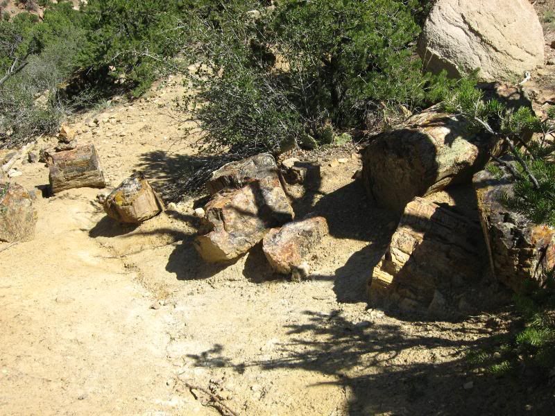
I think the hike was about a 1.75 mile loop. I was gassed afterwards.
I took a break in the air conditioned ranger station, reading the letters that were sent with returned pieces of petrified rock that were taken from the park. Seems if you take a piece bad luck will befall.
Once back on the bike I continued through Escalante and into another world: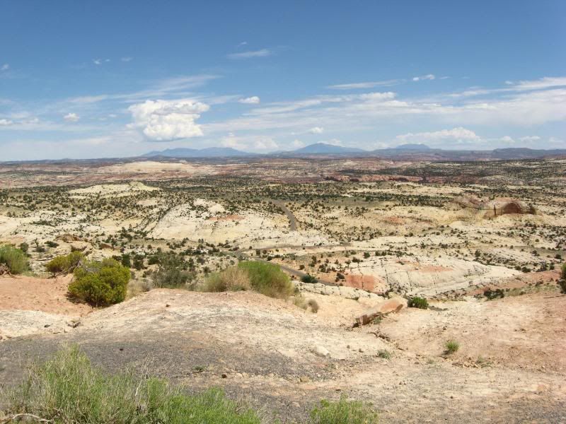
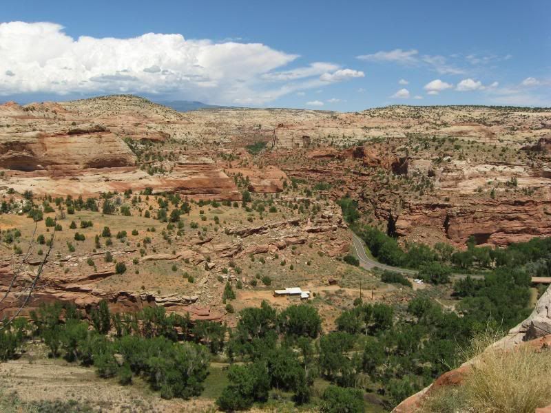
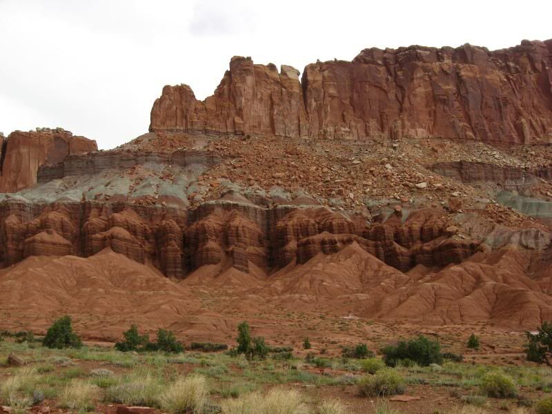
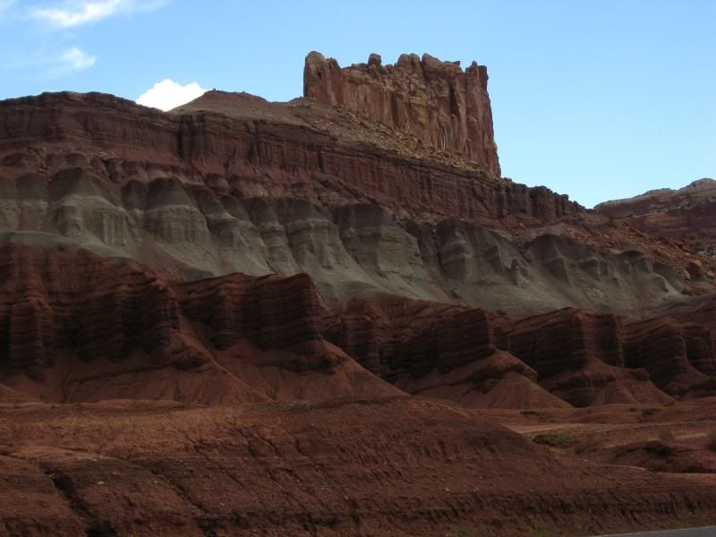
I continued through this landscape, up over a 9200 foot pass and down into Capitol Reef National Park. I was getting chased by a pretty severe storm, so my time in this park was cut short. This could be a park I would spend days exploring. The scenic drive road was closed (I would have surely gotten hit by the storm had it been open), so I made my way through the park on Rt. 24.
I went through here way too fast, but once again, that straight line lightning had me a bit worried.
Onward I pushed, through lunar looking landscapes along Rt. 24.
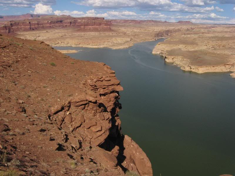
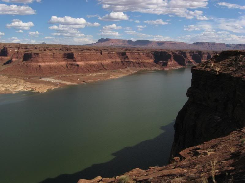
I turned South in Hanksville onto Rt. 95. I soon was seeing Glenn Canyon National Recreation Area: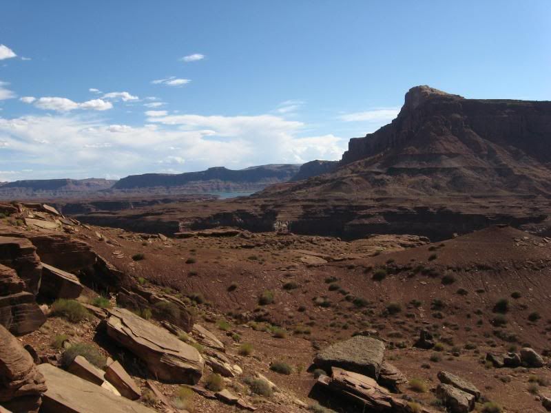
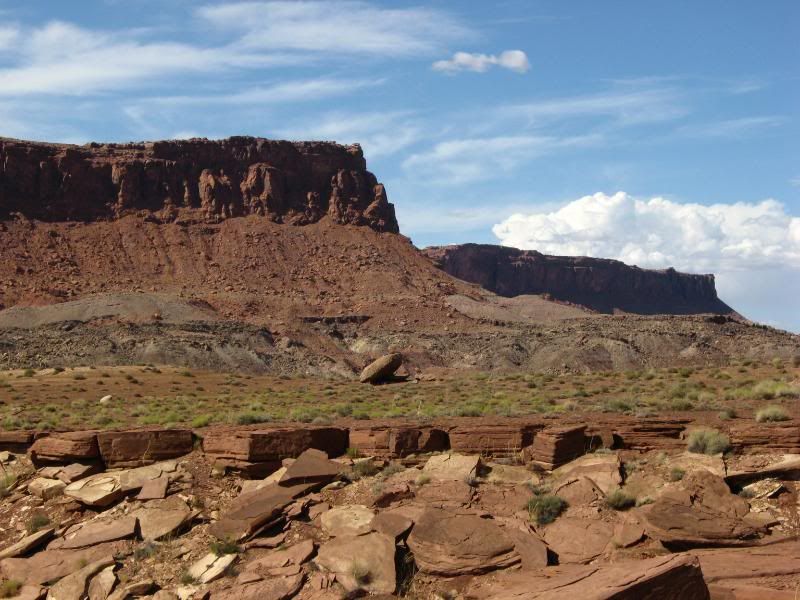
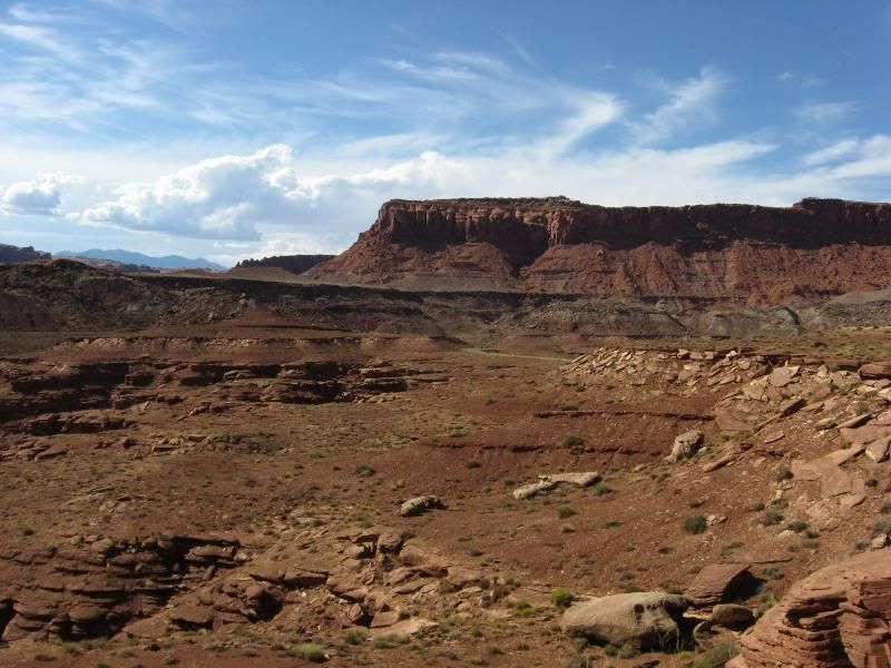
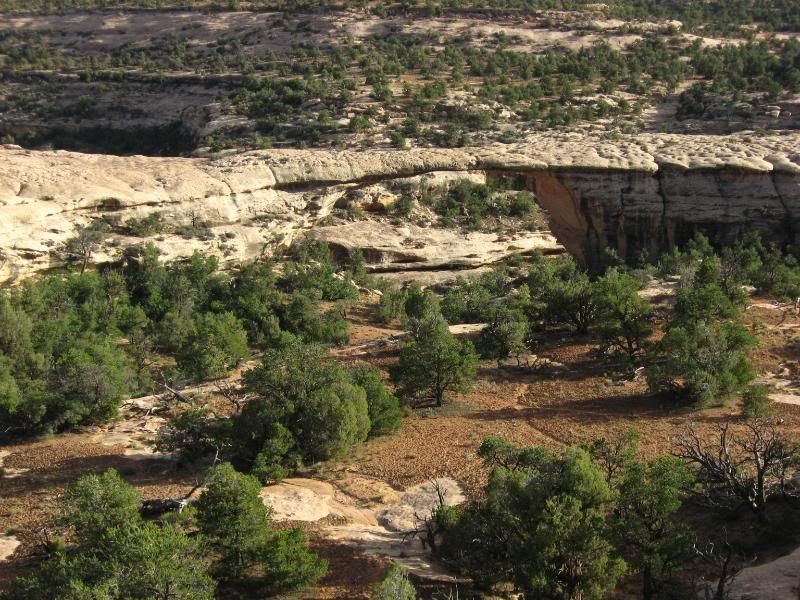
After riding through there, I decided on trying to get to Blanding for the evening. But my map showed one more area theat peaked my interest. Natural Bridges National Monument. Neat stuff: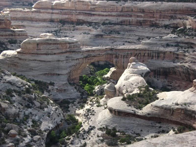
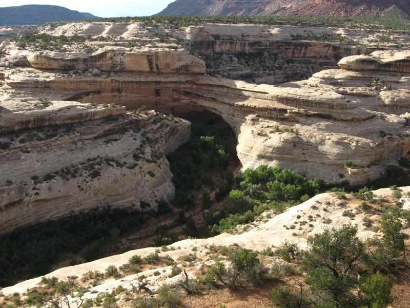
The park literature said there were arches in the park as well, but they were a bit harder to spot. I saw these two walking back from taking a picture of one of the bridges. The arch might be 4 inches tall: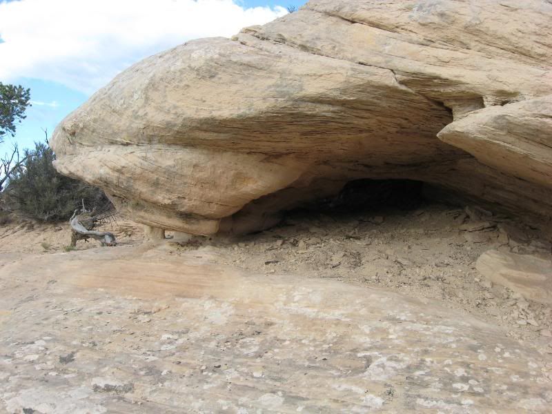
Onward to Blanding I pushed. And, there went Blanding.
I was now on UT191 heading North. Maybe Monticello would be the place to stop. Well, it should have been the place to stop. I fueled up there, donned all my gear for the darkening skies and kept the push North going.
About 20 miles outside of Moab, the skies opened up. Again, that straight line lightning I love. I kept my head low and pushed on into Moab. There I found a place for the night.
-darrell
-
-
When I woke up in Moab it was a bit later than usual. After a call back home to make sure everyone was still floating, and to a friend who lived just Noth of Denver (I was gonna try to stop and visit), it was pushing 10 am. I'd have to battle some National Park traffic today. Oh well.
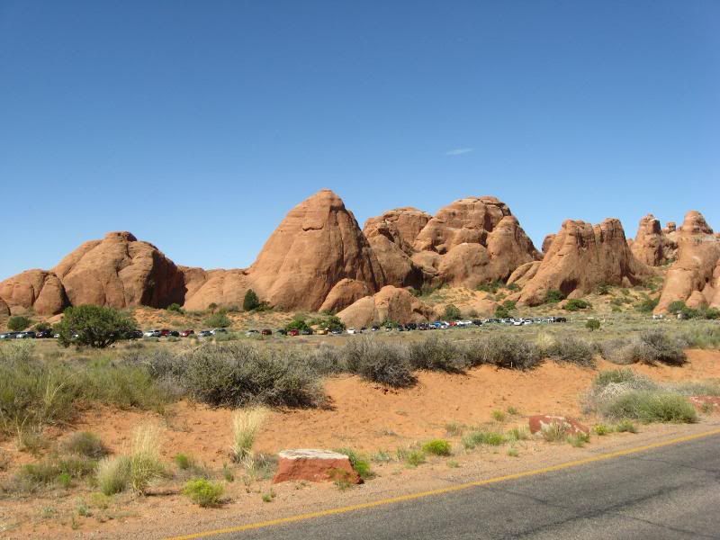
I headed out of Moab traveling North, greeted this morning by grand views of the red rock cliffs. I entered Arches National Park and the mass of people who had already decended upon it. I tried to take my time through the park, but the ammount of people really pushed me out faster than I liked. I still took time to grab some shots: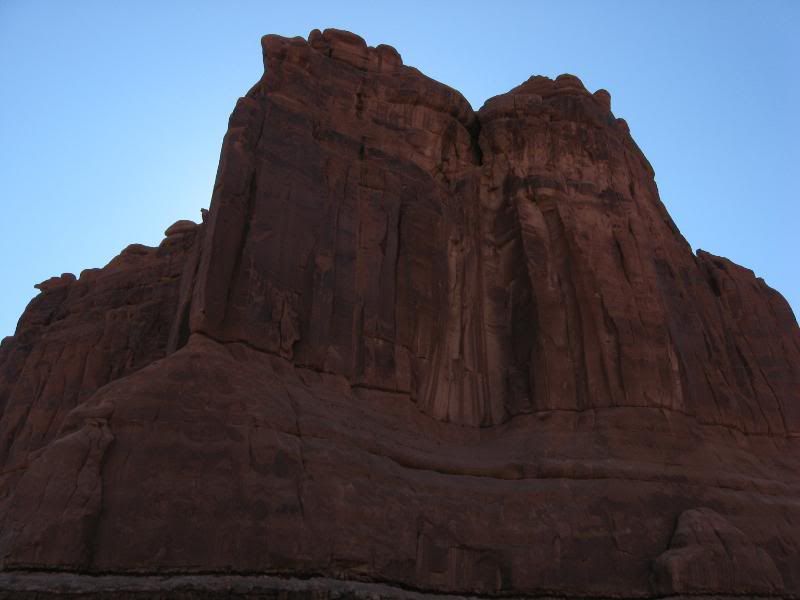
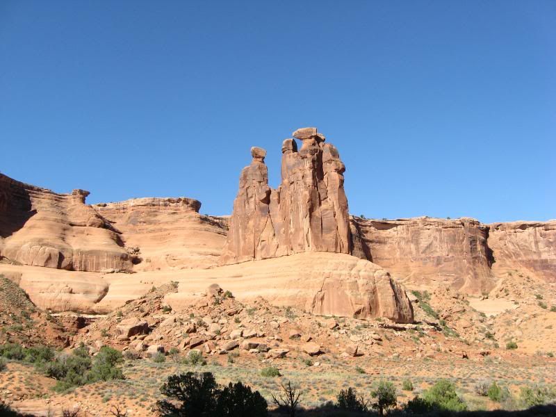
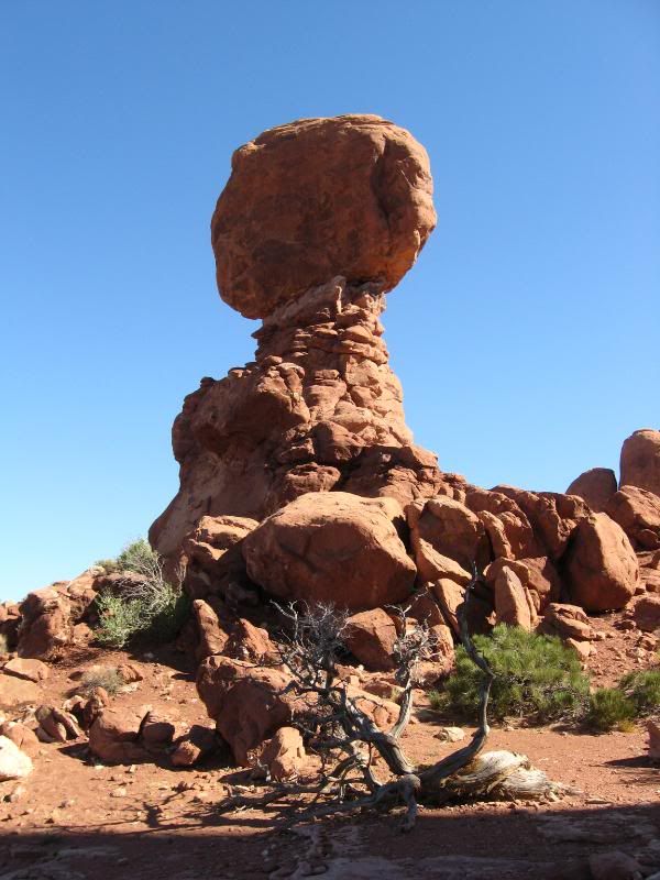
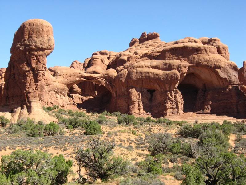
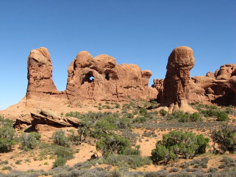
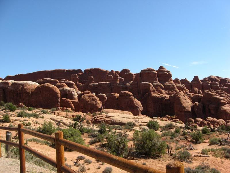
Here you can see, there wasn't a spot that wasn't filled up. Just too much for me: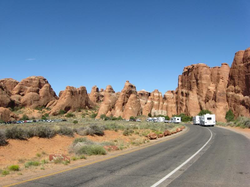
Even with trying to get out quickly, I spent a good two hours riding around, doing a few quick walks to grab a shot, and talking with a group of riders from the Denver area.
Once out of the park I continued North. I stopped for gas at a Shell station at the Rt 313/UT191 junction. All the pumps were filled up with Goldwings being operated by what I believed to be Finlandians. They were having a bit of trouble understanding the operations. I hung back, downing a large bottle of water and a good ammount of jerky.
I filled up after a pump had cleared and made my way onto Rt 313, on my way to Canyonland National Park through the North entrance.
It was a great ride.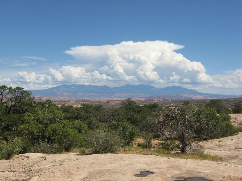
Those were the same clouds building that dumped rain on me the day before.
When I got to the end of the scenic drive in Canyonlands I was awestruck. I can't tell you how long I stood at the edge of a cliff there and just gazed at the beauty. My mouth was probably hanging down around my knees.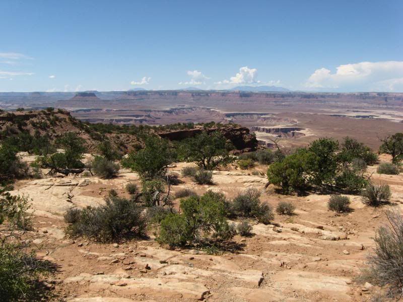
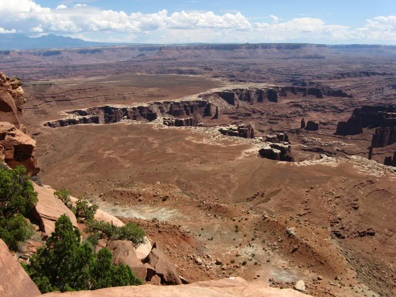
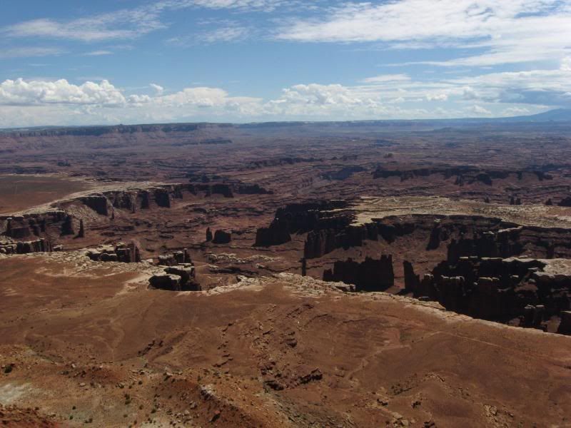
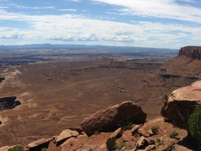
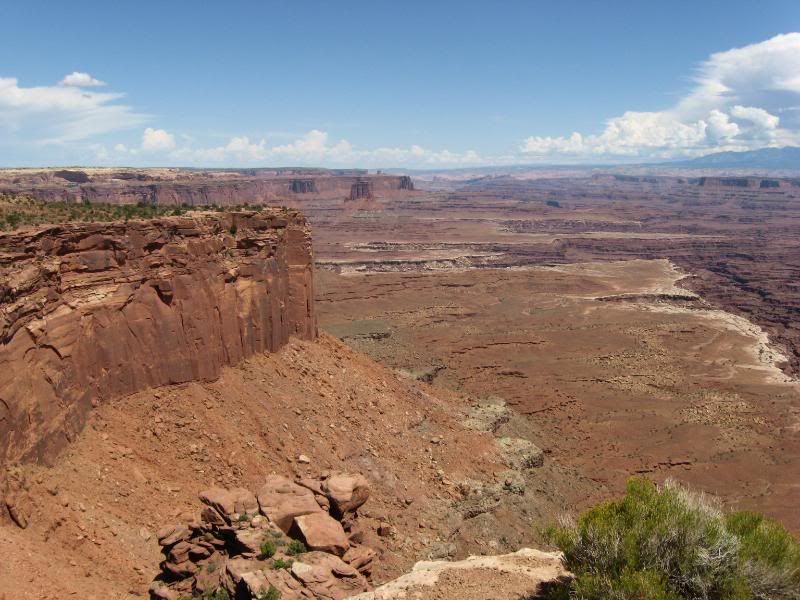
I felt absolutely miniscule with the land that layed out before me.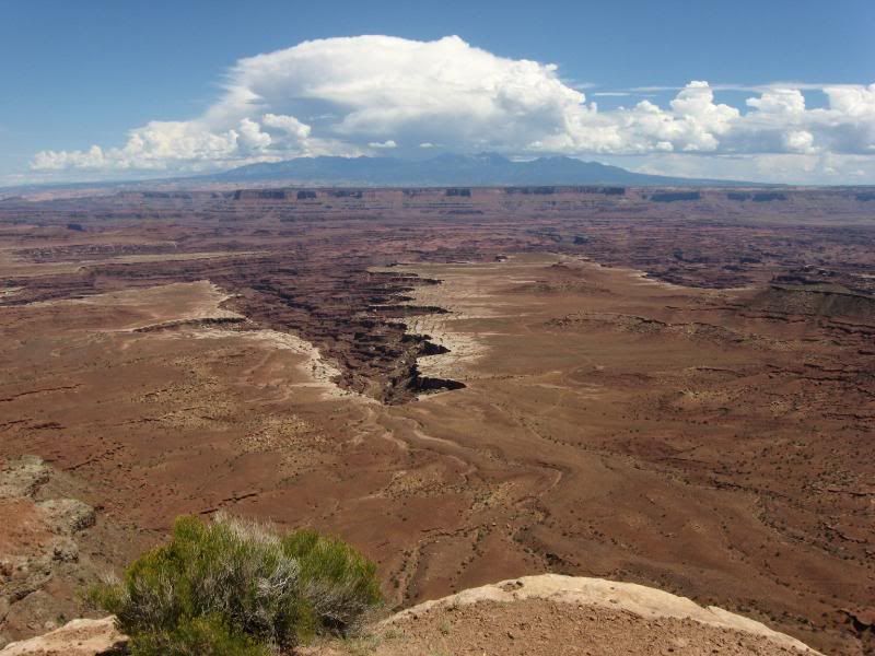
This was another park I wish I had days to spend. I removed myself from there after about three hours of wandering around.
I hit the road and made a plan. I'd try to get to my buddie's house in Broomfield CO that night. I took 191 up to I70 and started burning miles.
I pulled into Dean's place around 9 pm. His brother was home, but Dean and his wife were bowling. I parked the bike in the garage and proceeded to make myself at home, getting in some quality dog time with his two mini daschunds.
Dean got home about an hour after I got there, and like a good friend does, he had beverages. We caught up a bit, made a bit of a plan for the next day, and then I crashed on the couch about 1 am.
-darrell
-
-
We spent the next day at Sun Motorcycles looking things over and buying too much stuff.
We got back to his house and started servicing bikes (Dean is an avid off road rider/racer) and generally hanging out. About mid-afternoon Dean decided he would rent a bike and we'd go riding the next day. Sounds good to me.
He and his wife drove up to Thunder Mountain Harley Davidson (I followed on the bike) and rented a 2011 Road King. The same kind of bike Dean use to ride around Philly.
While his wife headed back, we took a ride. First to check on some of his guys working out at the local airport, then down to an asphalt plant to check on some more of his work crew. They had been putting in obscene hours and he had been pushing for a few days off for them all once the job completed.
We wound our way back to his place in time to order some pizza and wings and down a few brews. We decided to get an early start the next day and head for the mountains.
-
-
Early Sunday morning, Dean, his wife, and I left the house and headed North on I25. We jumpped off the interstate at exit 243 and headed straight for the Rockies.
After a few twists and turns, we ended up in Estes Park. We grabbed a quick breakfast and headed into Rocky Mountain National Park. This would be the last National Park of my trip.
We wound our way through the park, stopping a few times to grab some shots.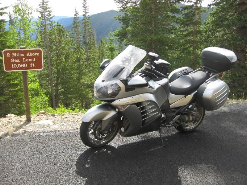
We'd make it over 12,200 feet that day. The highest I've been throughout the trip.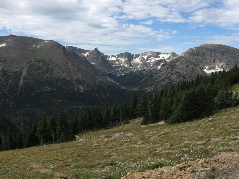
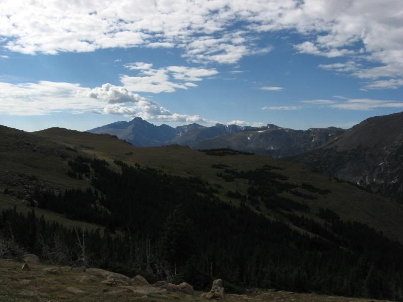
The last picture I took on the trip: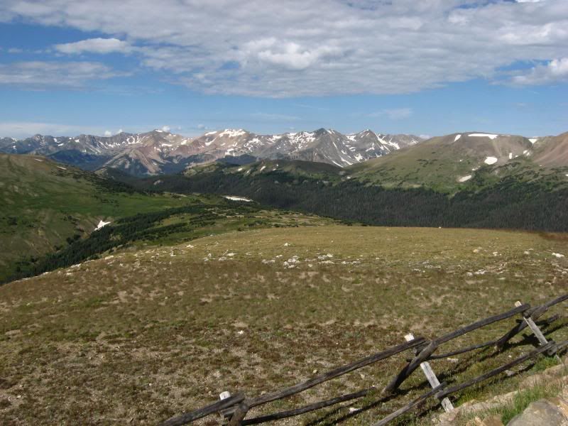
After winding our way through the park, we stopped in Fraser for lunch. Bellies full, we tackled Berthoud Pass. After spirited riding through the pass we headed back to Dean's.
My trip was winding down. I was a bit bummed, but glad to be making my way back home at the same time.
-darrell
-
-
I woke up early on Monday the 29th of August, downed a good strong cup of coffee, and said my goodbyes to Dean and his wife. I got out to the garage and noticed something not quite right with the bike. My seat was a bit askew.
After fiddling with the seat for about 15 minutes, bending a tab back into place, I finally got it to set right on the bike. I never start a long trip without some kind of hurdle.
I pulled out of Broomfield with a goal already set for the day. When it comes time for me to be home, that's where I want to be. This was one of those cases.
I dropped south on I25 to 270. When I got onto I70 I was happy to see all the traffic going the other way. Time to make some miles.
The ride back was uneventful but for the texting teen that ran a red light somewhere in Kansas, barely missing the back end of my bike. That would be the closest call of the trip.
I pulled into Indianapolis shortly before midnight. I picked a hotel on the Eastern side so I would miss most of the morning traffic, and proceeded to get some shut eye.
Without knowing it, I had picked the same hotel as I stayed in on my trip back home from Glacier in 2004.
Anyway, I again awoke early the next morning and made with making miles again.
Back in 2004, when I got onto 76 in PA, I had a feeling of being boxed in, with the trees, the Jersey barrier, and all the vehicles. This time I was too concentrated on what they call a road surface to be concerned with all that. Of the 10,000 plus miles I did on this trip, by far 76 was the worst excuse of a roadway I had been on.
As soon as you hit 76 there are road construction signs. And they didn't stop for the entire length. Hey, PA, lemmie give you some advice. Leave the road construction signs up at each end of your roadway, take all the ones in the middle and sell 'em for scrap. With the money you make you might be able to get 10 miles of that POS roadway paved right.
Anyway, I rolled into my driveway about 6:30 pm after dealing with rush-hour traffic in Philly.
The breakdown of the trip went something like this:
27 days on the road (9 in Glacier National Park). 19 different States. A dozen crossings of the Continental Divide. 10 National Parks.
10,154 miles
I'm ready to leave again...
-darrell
-
-
Just wanted to bring this thread back up for those newbs that may not have seen it. This is what most of us dream of! One day.....